Raleigh Durham International Airport (RDU)
Driving Directions / Travel by Car
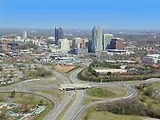
(Raleigh, North Carolina - NC, USA)
Sandwiched between both the cities of Durham and Raleigh, the airport is around 25 minutes drive from each. Located on the southeastern outskirts of Durham and on the northwestern side of Raleigh, you will find the Raleigh Durham International Airport (RDU) alongside the I-540 interstate (Northern Wake Expressway), which skirts the northern edge. To the southwest, the I-40 interstate (Tom Bradshaw Freeway) runs in a northwest / southeast direction and links the two cities.
Prominent landmarks close to the Raleigh Durham Airport include the vast William B. Umstead State Park, which is situated to the east and dominates the area. To the south is Lake Crabtree and also the popular Lake Crabtree County Park, while the Brier Creek Reservoir lies to the west. To the north of the airport, both the Brier Creek Country Club and the Brier Creek Shopping Center are sited just off the I-540 interstate and close to the US-70 highway.
Directions to Raleigh Durham International Airport (RDU) from Raleigh city center:
- The airport is situated 10 miles / 16 km northwest of Raleigh city center
- Follow signs to Interstate I-40 and head in a northerly direction
- The terminals are linked by junctions 284 and 285, with clear signposts
Directions to Raleigh Durham International Airport (RDU) from Durham
- The airport is situated 10 miles / 16 km southeast of central Durham
- Take Highway 147 (East-West Expressway) or Highway 70 (New Raleigh Highway) and continue along the I-540 interstate (Northern Wake Expressway) in a southerly direction towards Interstate 40
- The terminals are linked by junctions 284 and 285, with clear signposts
Raleigh Durham International Airport (RDU): Virtual Google Maps
